Overview
Map

Introduction
The hike of the Higher "Fanes" Falls is a challenging walk, with a length of twelve kilometers, or seven miles and a half. This amazing hike starts and ends in the locality of "Fiames" and will take about three hours, with a positive elevation gain of around five hundred meters, or sixteen hundred feet.

You can find this hike to the High Waterfalls of "Fanes" on the Tabacco Map 003 - "Cortina d'Ampezzo Dolomiti Ampezzane." It starts by climbing Path 10 and continues along the upper part of the Path of Canyons and Waterfalls. Alternatively, you can follow our track on Google Maps by clicking here.
This is a challenging hike, with some very steep climbs and a technical trail suitable only for experienced hikers. The last part of the hike includes an optional via ferrata, for which climbing equipment is required. It is not a suitable hike for small children or anyone with reduced mobility.
 Help us stay ad-free with a small offer.Donate now!
Path of the Hike
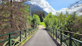
The hike to the High Waterfalls of "Fanes" starts at this parking lot of the Ampezzo Dolomites Park, near the park's visitor center. If you need more information on how to reach it, we'll describe it in depth further on the page, in the chapter "How to Get There."

Once you have parked your car, head towards the visitors center wooden house, cross the barrier that blocks car access, and start walking along Path 10. After a few meters, on your right, you'll see a suggestive gorge, called "Forra del Felizon," that has been dug by the flow of the "Felizon" Stream.

After about one hundred meters, or three hundred feet, you'll reach the intersection named Ponte Felizon, 1350 m. Take the road to the right, continuing along Path 10 towards "Cascate, Val di Fanes, Val Travenanzes." It means Waterfalls, "Fanes" Valley, and "Travenanzes" Valley.

Along the way, you can observe some botanical signs describing the plants growing along the road.The walk continues for about thirty minutes, alternating some uphills with relaxing descents, always on an asphalt road.

Once you reach the intersection of "Pian de Loa," easily recognizable by the bench and the sign Pian de Loa, 1349 m, take the road to the left towards Ponte Outo - Cascate sent. Ferrato. It means High Bridge, Waterfalls, Iron Path.

After a few meters, you will cross the bridge over the "Rü de Fanes," a splendid alpine stream where you could relax or sunbathe on its banks. This could be a great spot to rest in the way back; after climbing the Fanes Waterfalls, keep it in mind.

After crossing the stream, proceed through the woods for about thirty minutes. Initially, the gravel road is flat, but the climb will gradually increase in steepness without becoming excessive.

Proceed until you reach the "Ponte Outo," which literally means High Bridge in the local dialect. From here you can look down on the impressive gorge carved by the "Rü de Travenanzes" stream and look at the splendid panorama.
We recommend catching your breath; there are also some benches and tables because from here on the hike will change pace and it'll become quite challenging.

From the "Ponte Outo," continue for about one hundred meters, or three hundred feet, until you reach a second rest area with benches. Here you will see a wooden sign named Cascata di Fanes, 1467 m. Take the path to the right; it is really steep.
Follow the direction Path 10 "Dei Canyons e delle Cascate;" this is the last time we'll remind you it means "Path of Canyons and Waterfalls."

You have to climb a steep uphill three hundred meters, or one thousand feet long. When you'll see the wooden sign "Buš de l'orso," 1507 m, you will have to turn right, towards the path indicated by the wooden sign "Dei Canyons e delle Cascate."
Pay close attention to this intersection: it leads to a narrower path, and both the sign and the trail could easily go unnoticed.

After a few meters in the woods, you will cross an iron bridge that crosses the "Rü de Fanes," the stream that gives its name to the waterfalls.

From here on, the road surface becomes a classic forest trail, with some roots that may become slippery when they are close to the water of the stream or if it rains. If you have doubts about the direction, spot the red and white trail markers painted on the trees.

After a few minutes, you will encounter the first very steep equipped climb, characterized by iron ladders that ascend along the path carved by the water. The sun on your head certainly doesn't help to tackle the challenging climb, which will occupy you for about five hundred meters, or fifteen hundred feet.

We suffer a little from vertigo, but we had no problems on this hike. If you suffer a lot, or if you want to completely avoid any potential risk, don't do it.
The effort of the climb will be amply rewarded by the panorama that awaits you at the next iron bridge, which crosses the first of the three High Waterfalls of Fanes. Congratulations, the toughest part of the hike is behind you.

After crossing the waterfall, you will find a small intersection where you need to turn right. Keep following the unnumbered path "Dei Canyons e delle Cascate."
Half an hour of a really relaxing walk in the forest awaits you, always accompanied by the sound of the rushing water.

When the sound of water gets louder, you'll see in the distance the second waterfall of the "Rü de Fanes." As you get closer, the mist from the water will refresh you; if the day is very hot, it will be a real blessing.

The trail continues along the left side of the waterfall before entering the woods. This is likely the most enchanting part of the entire hike, offering splendid views of the river, perfect for capturing memorable photos.

After about thirty minutes, you will reach the more majestic waterfall, known by the name "Sbarco de Fanes." In addition to being very impressive, the waterfall can be crossed via an exciting via ferrata, which allows you to pass behind the water drop.

Continue to the left of the waterfall until you reach the intersection marked by the sign "Sbarco de Fanes," 1728 m. Now you have to make a decision:
If you prefer to avoid the via ferrata, follow the unmarked direction, so go to the left. In a few meters, you will reach Path 10, the wide gravel road; take the left and go down along the main path until you reach the "Ponte Outo" again. From there, you will simply have to retrace the steps you've done on the way there.

If you decide to take the via ferrata "Cengia de Mattia," keep following the sign in the direction of Sentiero dei Canyons e delle Cascate.
Remember: this is a technical passage, with a requirement for climbing equipment and experience with hikes. If you suffer from vertigo or you have never faced a via ferrata before, you should really avoid it.
... this is a technical passage, only for equipped hikers...
The first part is reasonably simple and will allow you to pass behind the waterfall drop. In its simplicity, it is definitely an exciting experience. At this point, you might be satisfied and decide to turn back, but if you're feeling adventurous, the via ferrata continues.

Once you have crossed the waterfall, you have to climb up a wall equipped with U-bolts and a safety cable. As you can see, it's rather difficult.

From here, after a few minutes of climbing, you will reach a path that leads to a wooden bridge. Once you have crossed it, turn left to reach the intersection called "Sbarco de Fanes." It is on Path 10, the same path we took on the way there, only much higher.

The hike to Upper Fanes has likely taken you a couple of hours so far. To return to your car, you will need to descend along Path 10, following signs for Ponte Outo and the path "Dei Canyons e delle Cascate."
After about five hundred meters, you will come to a wooden sign with the name "Pian dai Šente," 1682 m. The path to the left, towards "Scorciatoia," is a shortcut, but it is quite steep. If you decide to take it, keep following the signs for "Ponte Outo."

If you keep to the main road, avoiding the shortcut, you will reach the intersection of "Progóito," 1633 m. There, the signage will suggest turning right, but we suggest going straight along the main road. Follow the signage towards "Ponte Outo" and Path 10.
The detour towards the right, labeled "Dei Canyons e delle Cascate," would get you to a bridge called "Ponte dei Cadorìs." Honestly, although it is a charming route, if you are tired it does not offer enough beauty to recommend this extra effort.

Proceeding down the road, you'll get in the rest area near Ponte Outo again; it is the one marked by the sign "Cascata di Fanes," 1467 m. From here, all that remains is to retrace the path you took on the way up; you'll be back to the parking lot where you left your car, near the park's visitor center.
If gazing at this amazing panorama helps you find unexpected energy, keep reading, as we have one last proposal for you.

From this rest area, you will see a wooden sign directing you towards "Sentiero Attrezzato alla Cascata." It means "equipped waterfall trail," and it's a short path called "Ferrata Giovanni Barbara." This brief detour will allow you to pass behind the waterfall again, but this time at the lower Fanes waterfall. You should have the necessary gear with you, so why not go take a look? It's really worth it.
 Help us stay ad-free with a small offer.Donate now!
Curiosities
There are several intersecting paths that offer different approaches to this hike. Some are gravel roads that are rather easy to walk on, while others are challenging via ferratas. In this case, for example, we only followed half of the path "Dei Canyons e delle Cascate." If you are looking for something more challenging, you could do the Canyon and Waterfall Path entirely, or you could skip it, making the walk even easier. If you want more information about the other paths in the lower section, you may read our page below about the hike to the Lower Fanes Waterfalls.

During the first part of the hike, you may have noticed some trees carved by the black woodpecker. Here lives the largest specimen in Europe, which digs into the wood in search of insects with its strong beak, contributing to the control of tree pests. This bird had almost disappeared from Cortina, but in recent decades it has returned to populate the woods of Ampezzo, especially those of this hike and the surroundings. The most affected tree can be seen just before the intersection of "Pian de Loa," indicated by a sign from the "Regole d'Ampezzo."
"Ponte Outo" rises on a gorge carved by the stream "Rü de Travenanzes." It is the protagonist of a tale, also written on the information board of the "Regole d'Ampezzo." The legend tells of the deeds of the knight "Gran Bracun." This knight had to reach his fiancée in a close locality called "Podestagno." The local shepherds, annoyed by his passage, cut the supports of the bridge to make him fall into the ravine. However, Gran Bracun had an incredible intuition and jumped over the damaged bridge, leaving the saboteurs speechless and entering history. From that moment on, no one has disturbed his passage anymore. Unfortunately, we can't tell you if there's something real in this Dolomitic tale.

Regarding the legend we described above, on the "Ponte Outo," was displayed a painting depicting the jump of the Gran Bracun. It was commissioned by Alfred Mutschlechner, the historical owner of the Rifugio Fanes, and it was displayed around 1930 but was removed during a subsequent renovation of the bridge.
Help us stay ad-free with a small offer.Donate now!
How to Get There
Our version of the "Higher Fanes Falls Hike" begins at the free parking lot of the Ampezzo's Dolomites Park, near the small wooden house that serves as the Park Information Point. The best way to get there is with your car; from the center of Cortina, you will need around 15 minutes.
As this is the starting point of many hikes, you should get there early in the morning. This will increase your chances of finding a free spot during the peak season. If you can't find a free parking space, there's a second parking lot that might go unnoticed, located exactly here.
Another solution might be to take bus n°1 from Cortina's bus station and get off at the "Hotel Fiames," which is also the end of the line. From here, you have to take the gravel wooded road toward the north, which, in about thirty minutes, will take you to the car park. The road can be easily spotted from the bar blocking the traffic and from the sign that says "Bosco dell'Impero," which also indicates the "Val di Fanes."
For more information and to purchase tickets, you should contact the ticket office, which is located in the same office as the Tourist Information Center. It may be closed during lunch.
This walk is already quite challenging, but you may still decide to walk to the starting point of the hike from the town center. In this case, you'll need to walk two hours more along the walk known as the "Ex Ferrovia," translated as former railway.
We have described this nice walk on a specific page, which you can visit by clicking below:
If you don't have a car, you may also consider a taxi. From Cortina to "Fiames," the price should be approximately €30, but it is better to ask the price beforehand, as this is a very rough estimate. You can find a taxi both in Piazza Roma, at the bus station, or using their website.
For any doubts you may have, you can consult the Tourist Information office in the center of Cortina.
Help us stay ad-free with a small offer.Donate now!
Useful information
This is one of the few hikes we propose that doesn't have a mountain lodge to welcome you upon arrival. For this reason, we recommend preparing a packed lunch or bringing a generous snack. If you want to eat at a restaurant in the locality of Fiames, you can find the Hotel Fiames, which offers the possibility of having lunch or a snack on its outdoor or indoor terrace. The cuisine is simple and genuine, and the cakes are irresistible. They have a homemade quality, and they are truly delicious. Alternatively, you can also stop at the Chalet Spiaggia Verde, where you can have a drink or something to eat and rent a sunbed to sunbathe on the banks of the Boite stream. We have personally never tried it under the new management, so we recommend reading some reviews before going.
The most suitable months for this hike are those between May and November. This is a slightly cautious estimate, but unfortunately, it is not possible to know in advance when it will snow or when the snow will melt. The most beautiful period is certainly spring, as the thaw makes the flow of the waterfalls much more abundant. The excursion is also very beautiful in summer, as the presence of the misty water allows you to cool off from the high temperatures.
The hike to the High Fanes Waterfalls and the via ferrata behind the waterfall are not practicable in winter and are highly discouraged in case of rain, as wet surfaces can become slippery and very dangerous. In winter, moreover, the path is crossed by the cross-country ski trail, and according to the regulations, it is forbidden to walk or snowshoe on it.
When you go for a hike, we recommend wearing suitable clothing. Given the length of the route, it is better to have tested shoes suitable for walking on dirt paths. Bring a backpack with lunch, some water, a snack, and a rain jacket. If you are new to mountain hiking, we recommend first reading our tips for walking safely in the mountains:

We want to emphasize that, in the territory of the Dolomites, there are rules to be followed. The main ones are:
- It is strictly forbidden to light fires.
- It is strictly forbidden to pick plants and flowers.
- Free camping is prohibited.
- It is prohibited to abandon garbage.
- It is mandatory to keep pets on a leash.
Always be responsible, and when in doubt, stop. CiaoCortina cannot be held responsible for any damage to things or people, variations, wrong paths, errors, or inconveniences that may occur along the route. For more information, click here.
Help us stay ad-free with a small offer.Donate now!
Conclusion
We hope you liked this page about the High Waterfalls of Fanes. Before saying goodbye, we would like to mention that you can find other amazing hikes in Cortina and its surroundings by clicking here.
If you want to thank us, you can read the page Support Us. If you only want to suggest a change, propose something, or just say hello, in the section Contacts and Info, you'll find all the ways to reach us.


